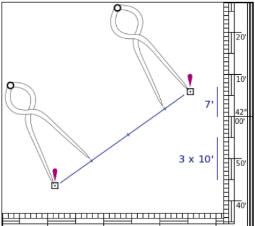
To measure the distance between, for example, these two oil rigs in the figure, we will need a set of dividers. It is very important to note that we can only use the vertical scale. We first take a convenient distance like 10′ (10 nautical miles) on the vertical scale in this case, using the middle latitude. Then we start walking with the dividers from the southern oil rig to northern one. Finally, we adjust the dividers to measure the small remaining part at its own height, i.e. its own latitude. The figure shows that the total distance is 37 nautical miles.

Reading coordinates and positions on the chart –
A pair of single handed nautical dividers can be used to obtain precise coordinates from a chart. This device enables us to take the distance between that particular position and the closest grid line (latitude/ longitude). Then the dividers are placed on to the scale on the side with one end on the same grid line, and letting us measure the coordinate on the other end. This way we can get both latitude and longitude at the scale given on the edge of the chart.
Measuring courses/ directions/ bearings on mercator charts –
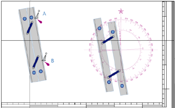
Moving further, we now come to obtain directions and bearings on the charts. For example, if we need to find the bearing/ course from safe-water buoy A to safe-water buoy B in the figure, we can use parallel ruler as shown in the figure. To begin with, we need to line up the parallel ruler with the two buoys. Then move the instrument to the compass rose without losing its alignment (You need to practise this). Finally, when one of the rules is aligned with the centre dot of the compass rose, the bearing can be read. In this example: 170°.
Besides the parallel rules, we can also use other instruments available, like the Portland or Breton plotter, two 450 triangles, etc.

Chart symbols and interpretation of information on charts –
Now we can see so many symbols and abbreviations on the chart. How do we interpret these correctly? We have already seen few symbols and meanings by way of our example to find the coordinates on the charts. What about the rest?

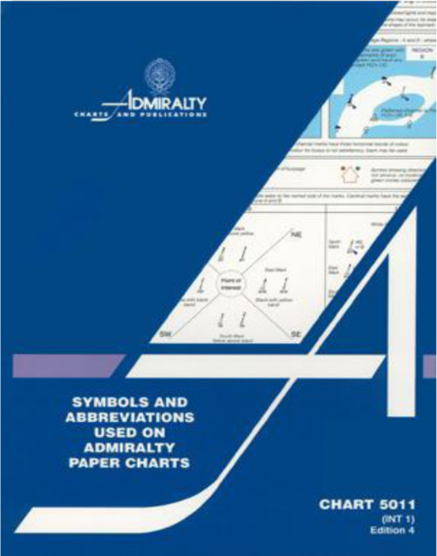
To get the details, hydro graphic offices generally publish a list of symbols and abbreviations used on their charts. For example, British Admiralty has Chart 5011 which gives a list of symbols and abbreviations used on British Admiralty and International paper charts. This publication is actually a booklet and is available on board all ships. This gives us symbols and abbreviations for general topographic and hydrographic markings used in charts and also for aids and services used. Familiarize yourself with this publication “CHART 5011” and refer to it when using chart. Below are few examples:
Tools for chart work –
As a professional navigator, you should be able to use the charts accurately. To do this, you must use the correct tools. Following is a general list of tools required for chart work:
- A suitably large and adequately lit (with dimmer controls) chart table to use all charts conveniently.
- 2B lead pencils. Scale wise, 1B is hard and 3B is soft, and pencils with an H grading are even harder. If a hard pencil is used, it is difficult to erase and it leaves a mark on the chart making it difficult to reuse them. If the pencil is too soft like 3B, it blackens out the chart making it appear untidy. 2B pencils are therefore recommended.
- If you are not using a mechanical or a clutch pencil, then good pencil sharpeners, usually fixed on the table top, should be available.
- Parallel rulers of at least 21 inches length.
- Good quality marine dividers (8 inches, single handed) and compasses.
- Good quality erasers to rub off courses and other markings plotted on the charts for re use.


