
Description
1) Introduction
In earlier days when electronic navigation was not available, navigation in the open sea was solely done using sun and stars to plot the ship’s position. Constellations were identified and stars which are most useful to navigation were tabulated in the nautical almanac for this purpose. 57 stars are used in navigation and they are shown in the daily pages of the almanac with their SHA and declination. A star chart showing the northern stars, the southern stars and the equatorial stars is also given in the almanac.
2) Star constellations
Constellations are identified by the shape the stars they contain take when seen from the earth’s surface.
Some examples are as follows:
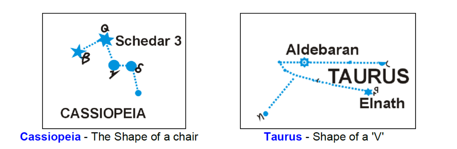
Look at the star chart given in the Almanac and familiarize yourself with these constellations.
3) Star finder and identifier
To assist the navigating officer in finding or identifying a star a “star finder and identifier” is provided. This consists of a star base with the northern sky on one side and the southern sky on the other, and seven (7) templates centered at 10º intervals of latitude along with an instruction chart. Each side of template is marked for use either in the northern hemisphere or southern hemisphere.
How to use the star finder to identify or locate stars:-
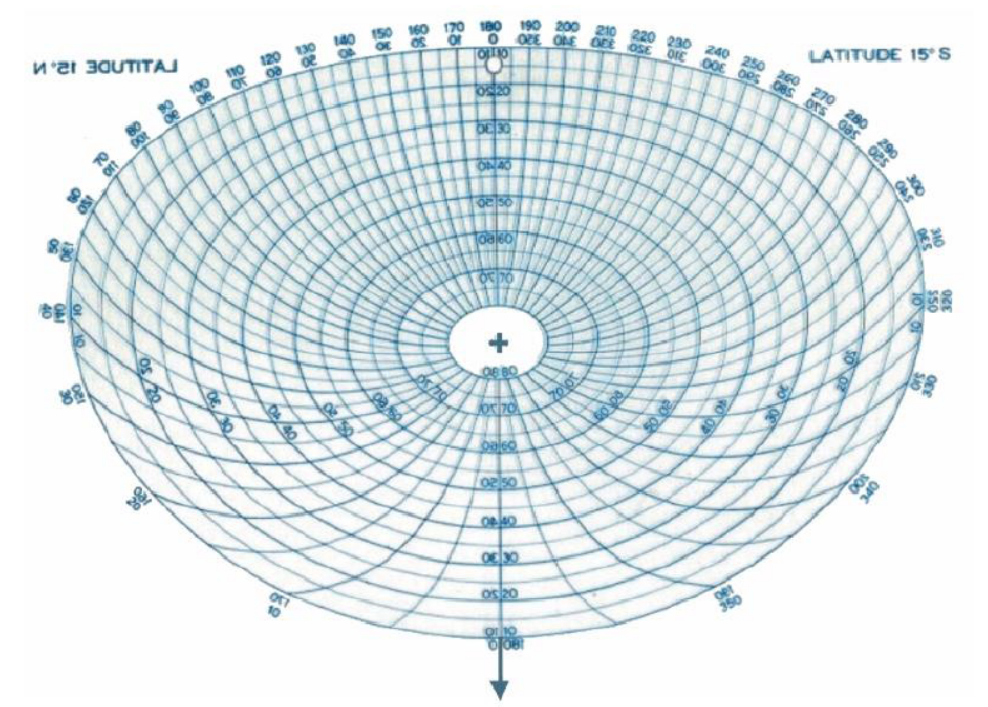
Template of 15 degree N latitude
Choose the template nearest to your DR (dead reckoning) latitude. For example if your DR latitude is 7º 30’N choose the template for 5º N. Center it on the star base by placing the hole over the pin in the center of the base, with proper hemisphere side up. Look up in the nautical almanac for that particular day and time and calculate the GHA (Greenwich Hour angle) for Aries. Apply the DR longitude to get the LHA for Aries. Rotate the template to bring the arrow of the 0º – 180º line to the degree mark on the outer edge of the base corresponding to LHA of Aries. The 0º-180º line when thus set for a specified time becomes the observer’s local meridian. Stars in the visible sky whose altitudes are over 10º are then enclosed within the blue grid of the template and their approximate altitudes and azimuths may be read off.
Look at the example below which will give you a better idea.
Example: At sea on May 24th, 1998, in DR latitude 38ºN, longitude 50ºW, GMT 05h 37m 00s find the altitude and azimuth of navigable stars visible in the sky.
GMT : 05h 37m 00s
GHA Y : (05h) : 316º35.8′
Increment 37m00s : + 9º16.5′
GHA Y (05h 37m 00s) : 325º52.3′
DR Long (50ºW) : – 50º00.0′
LHA Y : 275º52.3′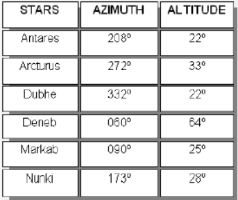
(DR Longitude to be subtracted if Longitude is West and added if Longitude is East)
Using the north side of the star base, place the 35º N template over the pin in the center of the base.
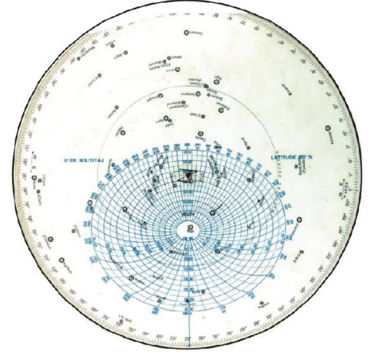
Set the arrow of lat 35ºN template on LHA Y of 275º 52.3′ and read the altitude and azimuth of stars enclosed with in the blue grid.
As shown above the star available at any time on the sky whether in the northern hemisphere or the southern hemisphere can be found out. Note only the 57 navigable stars having an altitude of more than 10º can be located.
