Index
1) Admiralty Notices to Mariners
2) Mariner’s Handbook (NP 100)
3) Catalogue of Admiralty Charts and Publications (NP 131)
4) Sailing Directions
5) Ship’s Routeing Information
6) Ocean passages for the world
7) Admiralty List of Lights & Fog Signals
8) Admiralty Tide Tables
9) Admiralty Tidal Stream Atlases
10) Admiralty List of Radio Signals
11) Routeing charts
Description
1) Admiralty Notices to Mariners
All the admiralty charts and publications are required to be maintained so that they are fully up-to-date for the latest safety-critical navigational information. The admiralty notices to mariners contain all the corrections, alterations and amendments for the UKHO’s (United Kingdom Hydrographic Office) worldwide series of admiralty charts and publications. These notices are published by way of weekly notices, cumulative notices and annual summary of notices to mariners for issue to ships. Notices, and the weekly editions containing such notices, are each numbered consecutively, commencing at the beginning of each year.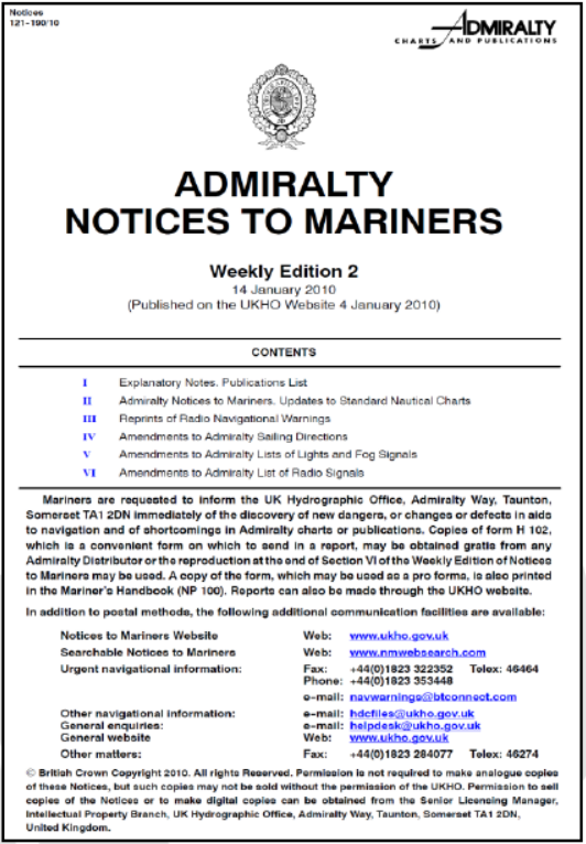
Weekly editions
Each weekly edition consists of the following sections:
I. Explanatory Notes. Publications List
II. Admiralty Notices to Mariners. Updates to Standard Nautical Charts
III. Reprints of Radio Navigational WarningsIV. Amendments to Admiralty Sailing Directions
V. Amendments to Admiralty Lists of Lights and Fog Signals
VI. Amendments to Admiralty List of Radio Signals
Each weekly edition is bound by staples to
enable Temporary and Preliminary Notices
and Sections III to VI to be detached for filing,
or to facilitate the correction of Admiralty
publications. In addition to the above
information the Weekly edition contains the
following information: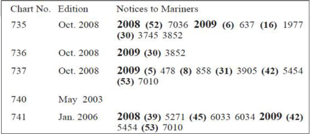
a. New charts and publications –
published during the week, information
on forthcoming charts and publications
(to be published), admiralty charts and
publications permanently withdrawn,
admiralty chart agent information, etc.
A list of current hydrographic
publications is published quarterly in
the weekly Editions of ANM. A notice
in Section II gives the dates of the
latest editions of the various volumes
of the sailing directions, list of lights,
list of radio signals and certain other
miscellaneous publications plus any
supplements affecting them.
b. Temporary and preliminary notices are
marked as (T) and (P) respectively,
and an asterisk adjacent to the
number of a notice indicates that the
notice is one based on original information, as opposed to one that republishes
information from another country. (T) And (P) notices which are in force at the end of the
year are published in the annual summary of admiralty notices to mariners. A list of T & P
notices and corrections to sailing directions in force is published monthly in the weekly
editions of ANM.
Cumulative List of Admiralty Notices to Mariners (NP234 A/B)
A Cumulative List of Admiralty Notice to Mariners was introduced in January 1986 and is
published annually, with Part A in January and Part B in July. The Cumulative List of Admiralty
Notices to Mariners (NP234 A/B) assists users who wish to identify outstanding Notices to
Mariners and audit trails for a particular chart or charts. It records the date of issue of the current edition for each chart and of subsequent relevant Notices to Mariners issued during the previous two years. It also contains a list of current Hydrographic publications.
In this list, the chart numbers refer to navigational charts in the Admiralty series, including
adopted Australian, New Zealand and Japanese charts (indicated by the prefixes AUS, NZ and
JP respectively). The edition date quoted indicates the month and year of publication of the
current edition (the relevant date is given in the bottom outside margin of the chart). This means that a chart carrying an earlier edition date than that quoted in this list is no longer valid and should be replaced. Newly published New Charts and New Editions are not included in this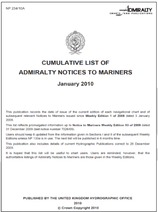
list until publication is announced in the Weekly Editions of Admiralty Notices to Mariners. The
Notices to Mariners quoted for each chart are those which have been issued over the past 2
years. Figures in bold indicate the week the notice was issued. If no notice has been issued
during the past 2 years, the most recent notice affecting the chart concerned is quoted. One of
the pages showing the list is shown in the figure for your reference.
Annual Summary of Admiralty Notices to Mariners (NP 247 – 1 & 2)
To supplement Weekly NMs, the UKHO produces an Annual Summary of Notices to Mariners (NP247), published annually in January. This publication now comes in two parts, i.e. NP 247 (1) and NP 247 (2).
Part 1 contains the Annual Statutory Notices to Mariners Numbers 1-26 and a summary of Temporary and Preliminary Notices to Mariners still in force at the start of the year.
Part 2 contains a Cumulative Summary of Amendments to Admiralty Sailing Directions. It provides the text of all amendments to current editions of Admiralty Sailing Directions which have been published in Section IV of weekly Admiralty Notices to Mariners, and which remain in force at the start of the year.
2) The Mariner’s Handbook (NP 100)
The Mariner’s handbook is a compendium of essential maritime information on charts; operations and regulations; tides, currents and characteristics of the sea; basic meteorology; navigation in ice, hazards and restrictions to navigation; and the IALA Buoyage system.
It is a very useful book for easy reference to a lot of topics like Surveying and charting, Admiralty charts, Admiralty publications (like Sailing directions, Ocean Passages for the world, Distance tables, List of lights and radio signals, Tide tables, explanation on the use of weekly notices to mariners, etc.), the sea, tides, tidal streams, chart datum, ice, Meteorology, international organizations, constraints on navigation, MARPOL, Navigation and aids to navigation, position fixing, GMDSS, etc. and many more.
3) Catalogue of Admiralty Charts and Publications (NP 131)
Catalogue of Admiralty Charts and Publications is a comprehensive reference in graphical and textual form of all Admiralty charts and publications worldwide, listed by region. The catalogue gives full details for each chart and publication, including details of all digital products and Admiralty distributors worldwide. This publication is updated and published annually. A loose addendum is supplied with each copy to bring the catalogue up to date for changes occurring during production. Any subsequent changes are announced each week in Section II of the weekly Admiralty Notices to Mariners. The first catalogue of charts was produced in 1825 by Hydrographic Department of the Admiralty.
Note that this catalogue does not cover the electronic charts. Full coverage of ENC electronic charts is listed separately in an online catalogue.
4) Admiralty Sailing Directions
Admiralty Sailing Directions, also commonly referred to as Pilots, are officially published books to complement Admiralty charts. Sailing Directions are designed for use by the merchant mariner on all classes of ocean-going vessels with essential information on all aspects of navigation. Sailing Directions provide worldwide coverage in 74 volumes. The areas covered under each volume are given in the Catalogue of Admiralty Charts and Publications (NP 131) and these publications are numbered as NP1, NP2 ….etc. Each publication contains quality colour photography and views, as well as information on navigational hazards, buoyage, meteorological data, details of pilotage, regulations, port facilities and guides to major port entry. New Editions of Admiralty Sailing Directions are published on a regular basis. Navigationally significant information/ corrections for these publications are issued via the Admiralty Notices to Mariners.
The sailing directions provide the mariner with comprehensive knowledge of an area he is unfamiliar with and is proceeding to. The Sailing Directions should be read in conjunction with the appropriate Admiralty chart quoted in the text. They are intended to aid the mariner in navigation at sea and are for all classes of vessels, from sea-going small craft up to the largest super-tankers. When consulting the Sailing Directions, the latest supplement in force should also be referred to for any corrections. Sailing directions are more useful for coastal passages than for ocean passages. For Ocean routeing, you may refer to routeing charts of various oceans which are published for every month of the year for each ocean along with Ocean Passages for the world.
Using the Sailing Directions –
Take out your chart catalogue and go to the section on sailing directions. Here you will find marked areas covered under each sailing direction and the sailing directions are numbered. Let us say we are going on a short voyage from Gibraltar to Bilbao (43º23’N, 003º05’W). From the chart catalogue on section on sailing directions – draw rough courses in pencil from Gibraltar to Bilbao and we can see that the areas are covered under sailing direction nos.: 67 (West Coast of Spain and Portugal Pilots) and 22 (Bay of Biscay Pilot). Chapter 1 & 2 of the sailing directions are general chapters containing details about Navigation & Regulations pertinent to the area, Country and port information, Natural conditions like maritime topography, currents, tidal streams, Sea levels, Sea water characteristics, Ice conditions, climate, weather etc. Other chapters contain details of each section of the area they cover as shown in the index chart. These details include Topography of the area, harbours and anchorages, coastal routes, principal and useful marks, description of various conspicuous objects, tidal streams and currents experienced, recommended approach passages and port. You must refer to the relevant chapters pertinent to your voyage.
5) Ship’s Routeing Information
Ship’s Routeing information is an IMO publication. This publication, which comes in loose-leaf pattern, covers all ships’ routeing, traffic separation schemes and mandatory reporting systems adopted by the International Maritime Organization and includes representational maps as well as full coordinates of all schemes. It provides areas to be avoided by ships and is intended primarily for Administrations responsible for planning and supporting routeing systems for use by international shipping. This publication includes General provisions on ships’ routeing, first adopted by IMO in 1973, and subsequently amended over the years, which are aimed at standardizing the design, development, charted presentation and use of routeing measures adopted by IMO. The provisions state that the objective of ships’ routeing is to “improve the safety of navigation in converging areas and in areas where the density of traffic is great or where freedom of movement of shipping is inhibited by restricted sea room, the existence of obstructions to navigation, limited depths or unfavourable meteorological conditions”.
There are two categories of routeing systems. The first category of routeing systems includes traffic separation schemes, two-way routes, recommended tracks, areas to be avoided, inshore traffic zones, roundabouts, precautionary areas and deep-water routes. The second category is archipelagic sea lanes.
Part A consists of General Provisions on Ships’ Routeing which have been developed to ensure that all adopted routeing systems conform to the same general criteria and principles.
Parts B to F include descriptions of routeing systems and associated rules and recommendations on navigation which have been adopted by the Organization.
Part G includes descriptions of mandatory ship reporting systems and mandatory routeing measures which have been adopted by the Organization.
Part H takes into account the unique character of archipelagic sea lanes as a routeing system and provides guidance for the preparation, consideration and adoption of proposals for the adoption, designation and substitution of archipelagic sea lanes.
Rule 10 of the International Regulations for Preventing Collisions at Sea, 1972 (COLREG 1972), as amended, prescribes the conduct of vessels within or near traffic separation schemes adopted by IMO. The text of rule 10 is reproduced in part B.
6) Admiralty Ocean passages for the world (NP 136)
Ocean passages for the world is a classic volume on ocean voyage planning, has routeing details for powered and sailing vessels; individual chapters on each of the world’s oceans; advice on winds, weather, climate, seasonal factors, currents, swell, ice hazards; and the shortest routes between ports and important positions. It gives numerous route diagrams and chartlets showing the effects of climate, wave heights and load line zones.
7) Admiralty List of Lights and Fog Signals (ALL)
“Admiralty List of Lights and Fog Signals” provide extensive information on all lighthouses, lightships, lit floating marks (over 8m in height), fog signals and other lights of navigational significance in 12 volumes covering the whole world. Each publication also gives the characteristics of lights and fog signals, together with the equivalent foreign language light descriptions. Tables can be used to calculate the geographical and luminous ranges of lights. Details for all lights listed include the international number, location and/ or name, geographical co-ordinates, characteristics and intensity, elevation in metres, range in sea miles and description of structure.
ALL are published in 12 volumes giving a world-wide coverage. These volumes are listed alphabetically as Volume A, B, C, etc. Each volume covers different geographical locations of the globe (See figure). The corrections to ALL are printed in Section V of the Weekly Notices to Mariners.
For each light the following details are given which are tabulated in eight columns in the List of Lights.
a) Number, used for indexing.
b) Name and descriptive position.
c) Approximate latitude and longitude.
d) Characteristics and Intensity of lights (when nominal range is not used).
e) Elevation of the light in metres above Mean High Water Springs (MHWS) level.
f) Range of visibility in sea miles.
g) Description of the structure on which the light is situated and the height of the structure above the ground in metres.
h) Phases, sectors, arcs of visibility, period of illumination, important temporary information, and other relevant remarks – In addition any minor associated lights, which do not merit separate numbering is also listed under the main light.
In addition, each volume contains tables for the calculation of the geographical and luminous range of lights; definitions of, and general remarks on, the characteristics of lights and fog signals; and a list of foreign language equivalents of the abbreviations used in light descriptions. In some volumes, special comments are found on problems peculiar to the areas covered by them.
ADMIRALTY DIGITAL LIST OF LIGHTS (ADLL)
Instead of using paper based list of lights, vessels may be provided with digital list of lights. The Admiralty Digital List of Lights provides light and fog signal information for more than 70,000 unique light structures worldwide. These can be updated weekly by email or by CD or by accessing the information online as soon as it becomes available. ADLL is being accepted in place of the paper version by most of the flag states.
8) Admiralty Tide Tables
Admiralty tide tables are published annually in four volumes for a worldwide coverage as follows:
Volume 1 – United Kingdom and Ireland (including European Channel Ports)
Volume 2 – Europe (excluding United Kingdom and Ireland), Mediterranean Sea and Atlantic Ocean
Volume 3 – Indian Ocean and South China Sea (including Tidal Steam Tables)
Volume 4 – Pacific Ocean (including Tidal Stream Tables)
Volume 3 & 4 also contain, in addition to tidal predictions, a number of predictions of tidal streams. Each volume is divided into three parts. Part I gives daily prediction of the times and heights of high and low water for a selected number of standard ports. Part II gives time and height differences for prediction of high and low water at a much larger number of secondary ports. Part III gives the harmonic constants for use with the Simplified Harmonic Method of Tidal Prediction for those ports, where they are known.
9) Admiralty Tidal Stream Atlases
The difference in tidal streams and currents are that tidal streams are astronomical in origin whereas currents are meteorological in origin. Tidal Streams are frequently referred to as Tidal Currents in the U.S.
Since Tidal streams are horizontal movements of water in response to tide-raising forces, they can be predicted for any period in future. Tidal streams which are semi-diurnal in character may be predicted by reference to a suitable standard port and are displayed in tables printed on the published chart. Since there is no necessity for daily predicted tidal streams to be published – these tables show the rate and direction of the predicted tidal stream of springs and neaps by reference to the time of high water at a suitable standard port. The area of prediction is indicated on the chart by means of a symbol with an alphabet – which can be referred to in the table.
Where the tidal streams may be related to a standard port and sufficient data is available, Tidal atlases are available showing rates and direction over a wide area. Such atlases showing the tidal streams in a pictorial form are available for all waters around the British Isles, West Coast of France and some other ports like Hong Kong. Each atlas contains 13 pairs of charts showing tidal streams at hourly intervals commencing 6 hours before HW at a standard port and ending 6 hours after HW at the same standard port. On the charts the directions of the tidal streams are shown by arrows which are graded in weight and, where possible, in length to indicate the approximate rate of the tidal stream.
Indicates weak stream indicates strong stream.
The figures against the arrows give the mean neap and spring rates in tenths of a knot, thus 19,34 indicates a mean neap rate of 1.9 knots and a mean spring rate of 3.4 knots. The comma indicates the approximate position at which the observations were obtained.
10) Admiralty List of Radio Signal (ALRS)
The Admiralty List of Radio Signals series provides comprehensive information on all aspects of Maritime.
Radio Communications. The data is organised into six volumes, some divided into several parts for ease of handling. Each of the six volumes is presented in a user-friendly format with full colour photographs and diagrams. The contents range from a complete listing of stations handling Maritime Public Correspondence to a full range of products and services essential for compliance with the GMDSS (Global Maritime Distress and Safety System). The volumes also feature radio stations broadcasting weather services and forecasts and a detailed explanation of the complexities of Global Satellite Position Fixing Systems. ALRS publications are updated through Section VI of the weekly editions of Admiralty Notices to Mariners. 
New Editions are published annually. The main features of each of the volumes are listed below:
NP281 (Parts 1 and 2) – Volume 1- Maritime Radio Stations
NP282 – Volume 2 – Radio Aids to navigation, Satellite Navigations Systems, Legal Time, Radio Time Signals and Electronic Position Fixing System
NP283 (Parts 1 and 2) – Volume 3 – Maritime Safety Information Services
NP284 – Volume 4 – Meteorological Observation Stations
NP 285 – Volume 5 – Global Maritime Distress and Safety System (GMDSS)
NP286 (Parts 1, 2, 3, 4 and 5) – Volume 6 – Pilot Services, Vessel Traffic Services and Port Operations
11) Routeing charts
The British Admiralty publishes routeing charts covering the whole world. Each chart has 12 volumes, with one volume for each month of the year. 
The charts provide meteorological information for passage planning through oceans and other areas of major traffic as mentioned below:
a. Major Shipping Routes
b. Load Line Zone Boundaries
c. Ocean Currents
d. Ice Limits
e. Wind Roses
f. Other Information


